recent Argo float profiles in the tropics


These plots are made possible by argopy, a Python library that aims to ease Argo float data access, visualization, and manipulation for regular users as well as Argo experts and operators. I convert depth from decibars to meters via gsw-python. Profile data are available in sufficiently deep water (≥2000 m). Click an image for the larger version. Missing images may occur when NOAA OISST updates are delayed on their THREDDS server.

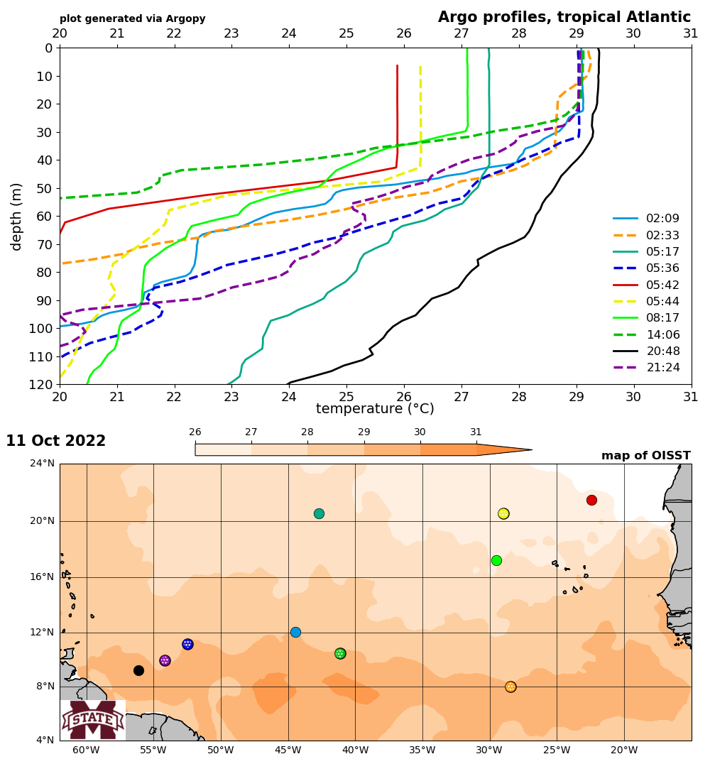
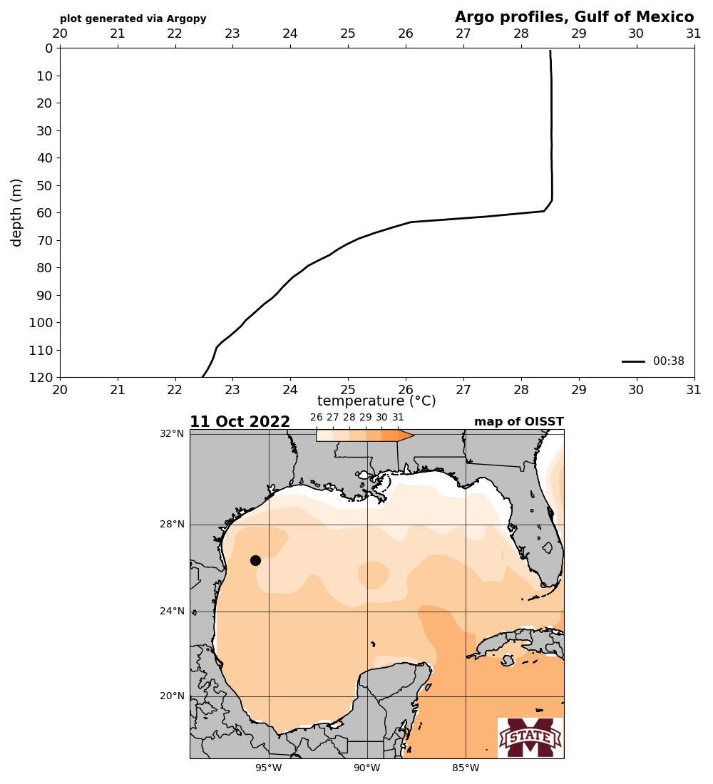
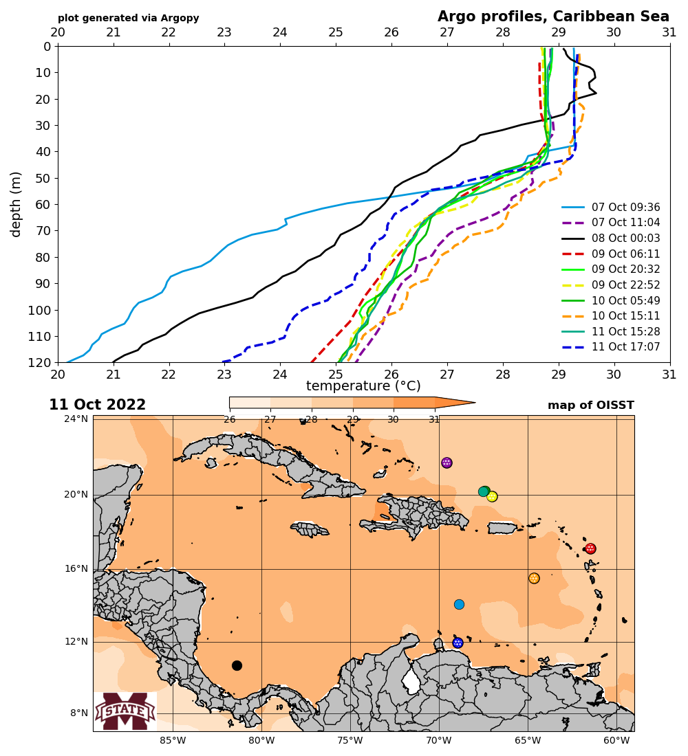
Current regional maps: North Atlantic MDR (60-20°W), Gulf of Mexico, and Caribbean Sea. Maps show the previous day's NOAA OISST product + Argo floats and should be automatically updated once per day around 9am CDT. Upcoming regional maps: open (subtropical) Atlantic, eastern North Pacific.


tropical Atlantic


Gulf of Mexico


Caribbean Sea


(page last updated 12 Oct 2022)