recent Argo float profiles in the tropics
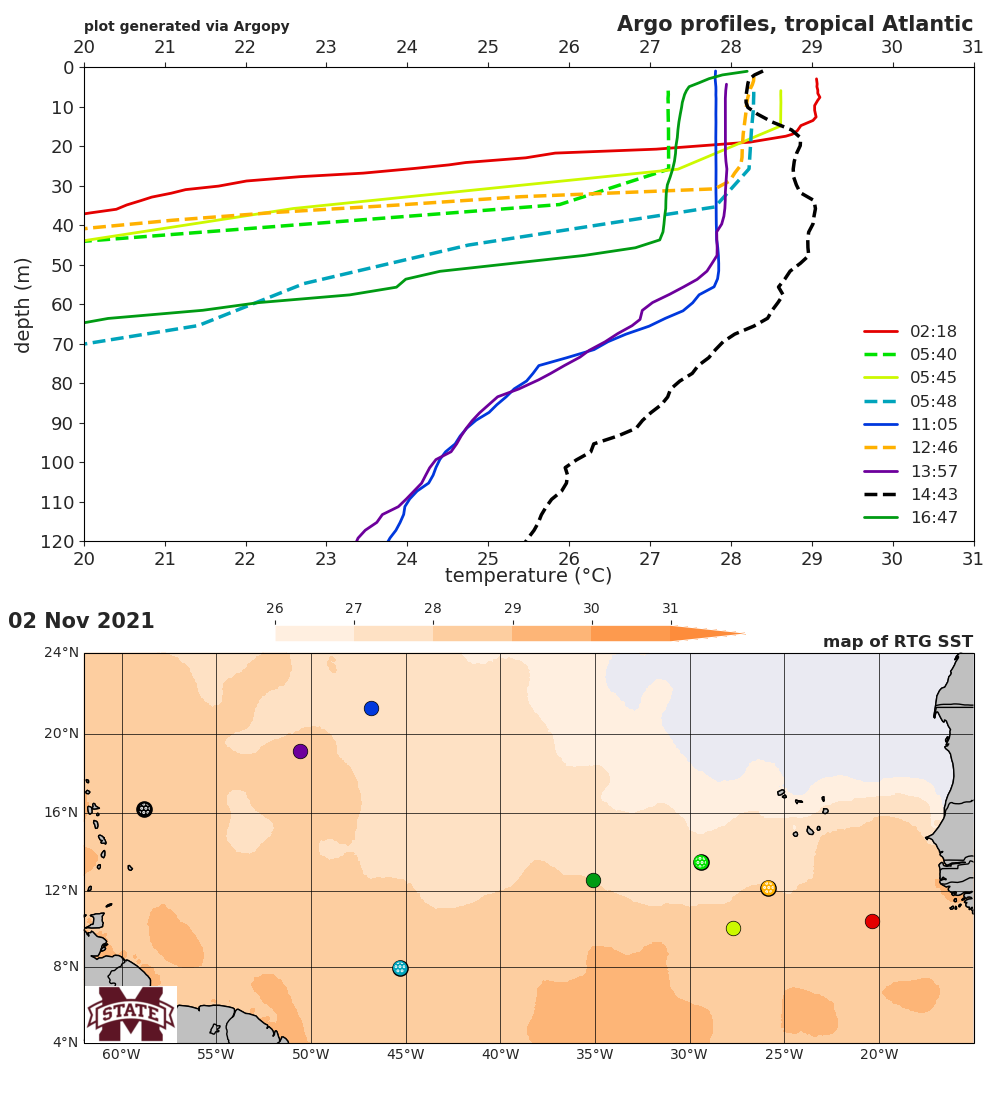
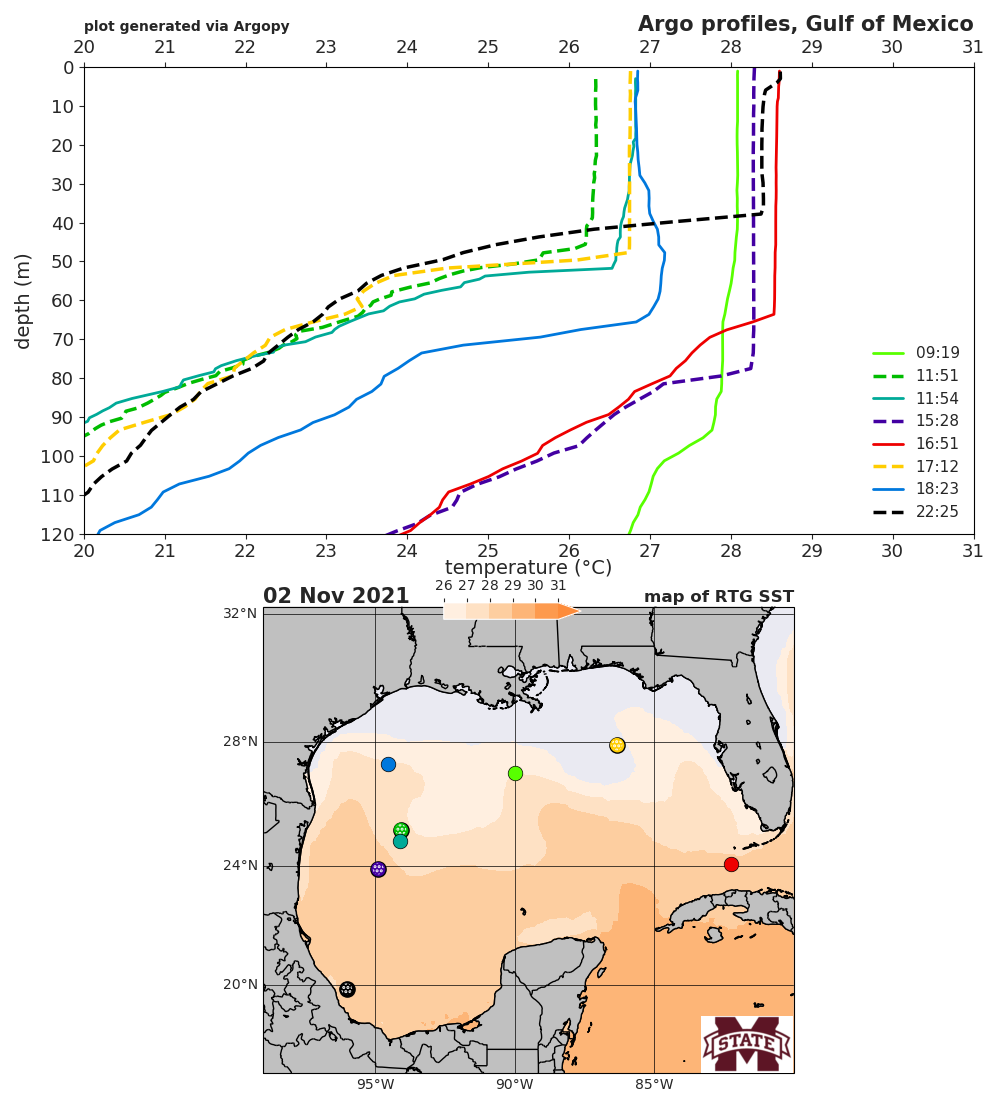
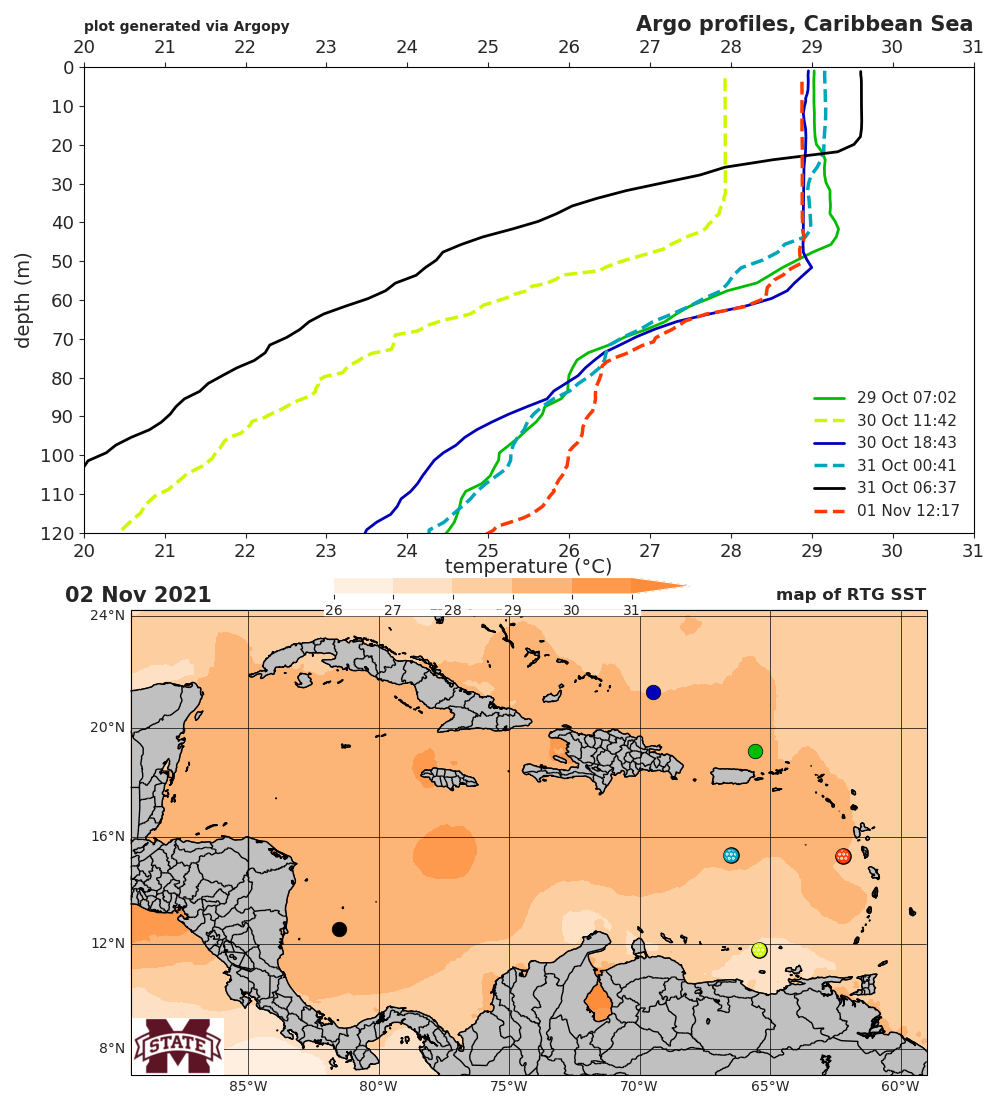
Current regional maps: North Atlantic MDR (60-20°W), Gulf of Mexico, and Caribbean Sea. Maps show the previous day's RTG SST product + recent Argo floats and should be automatically updated once per day around 9am CDT.
individual TCs
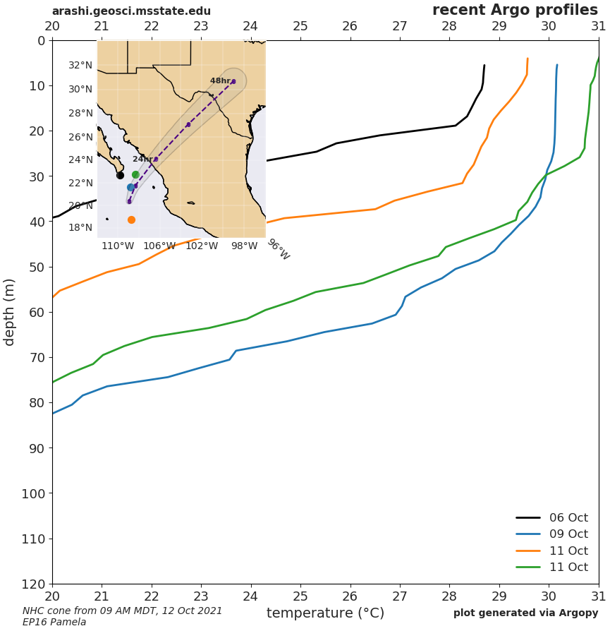
NOTE: these plots are generated on demand, usually for a TC's 15 UTC advisory.EP16 Pamela
- advisory 010 temperature (9am MDT 12 October 2021)
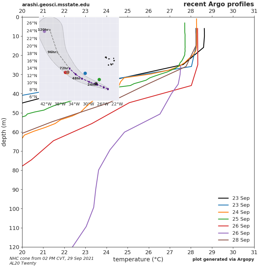
- advisory 005 temperature (2pm CVT 30 September 2021)
- advisory 001 temperature (2pm CVT 29 September 2021)
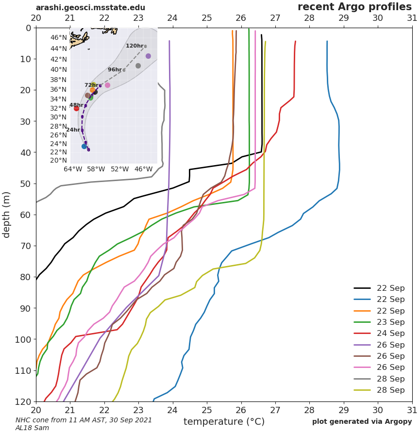
- advisory 032 temperature (11am AST 30 September 2021)
- advisory 028 temperature (11am AST 29 September 2021)
- advisory 024 temperature (11am AST 28 September 2021)
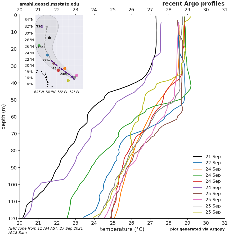
- advisory 020 temperature (11am AST 27 September 2021)
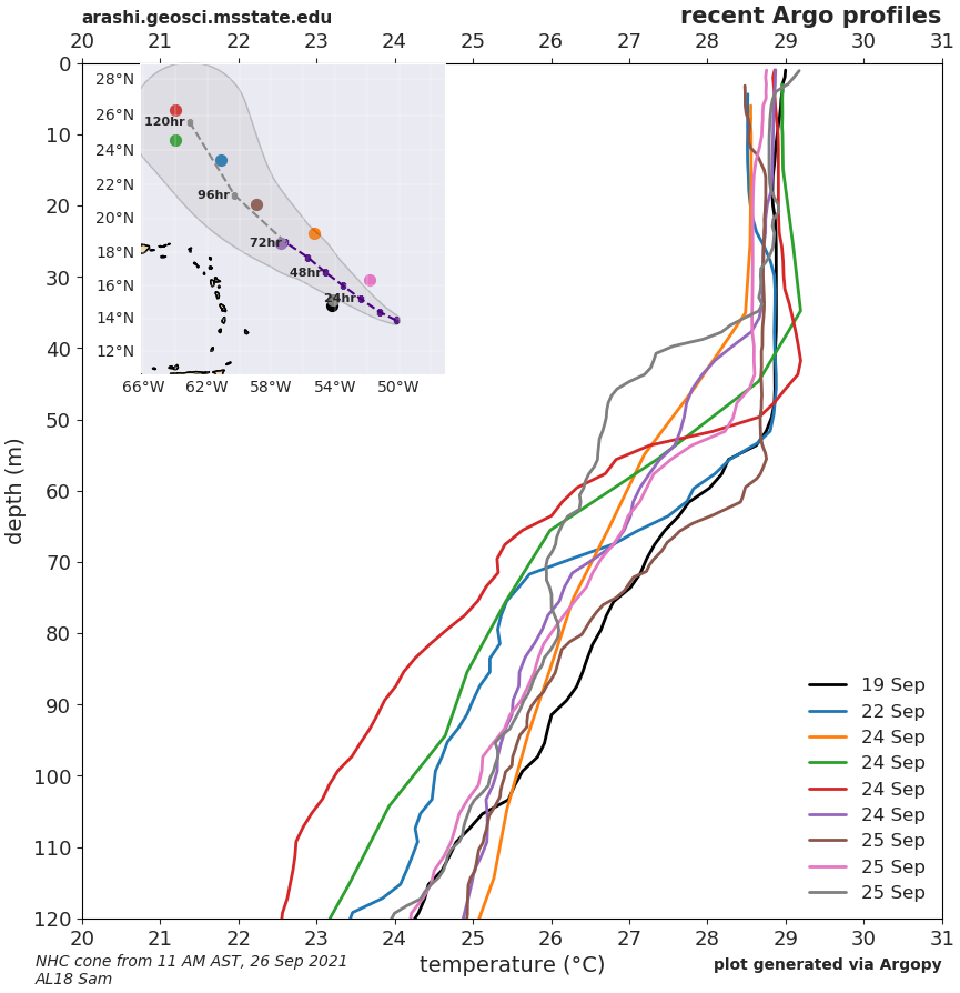
- advisory 016 temperature (11am AST 26 September 2021)
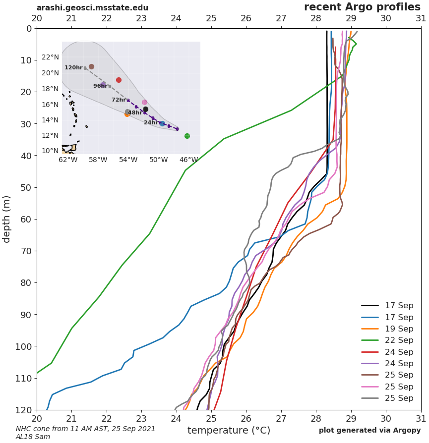
- advisory 012 temperature (11am AST 25 September 2021)
- advisory 008 temperature (11am AST 24 September 2021)
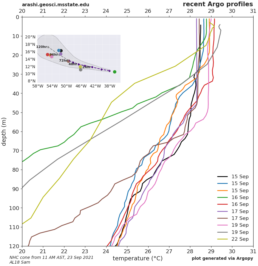
- advisory 004 temperature (11am AST 23 September 2021)
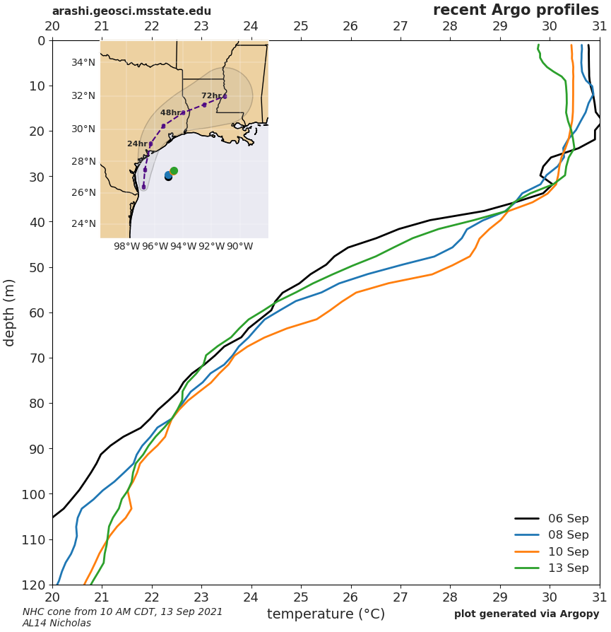
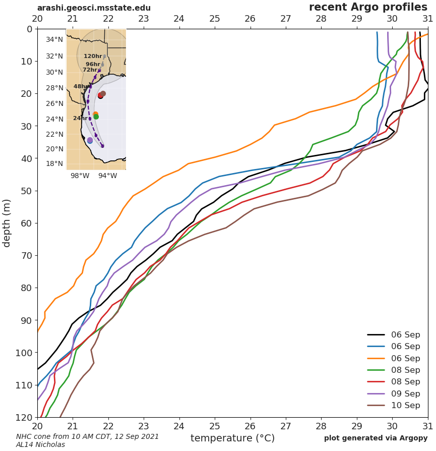
- advisory 006 temperature (10am CDT 13 September 2021)
- advisory 001 temperature (10am CDT 12 September 2021)
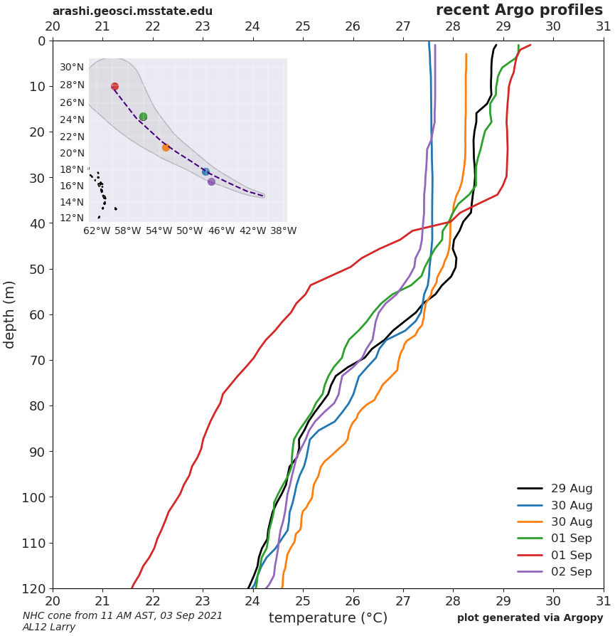
- advisory 012 temperature (11am AST 3 September 2021)
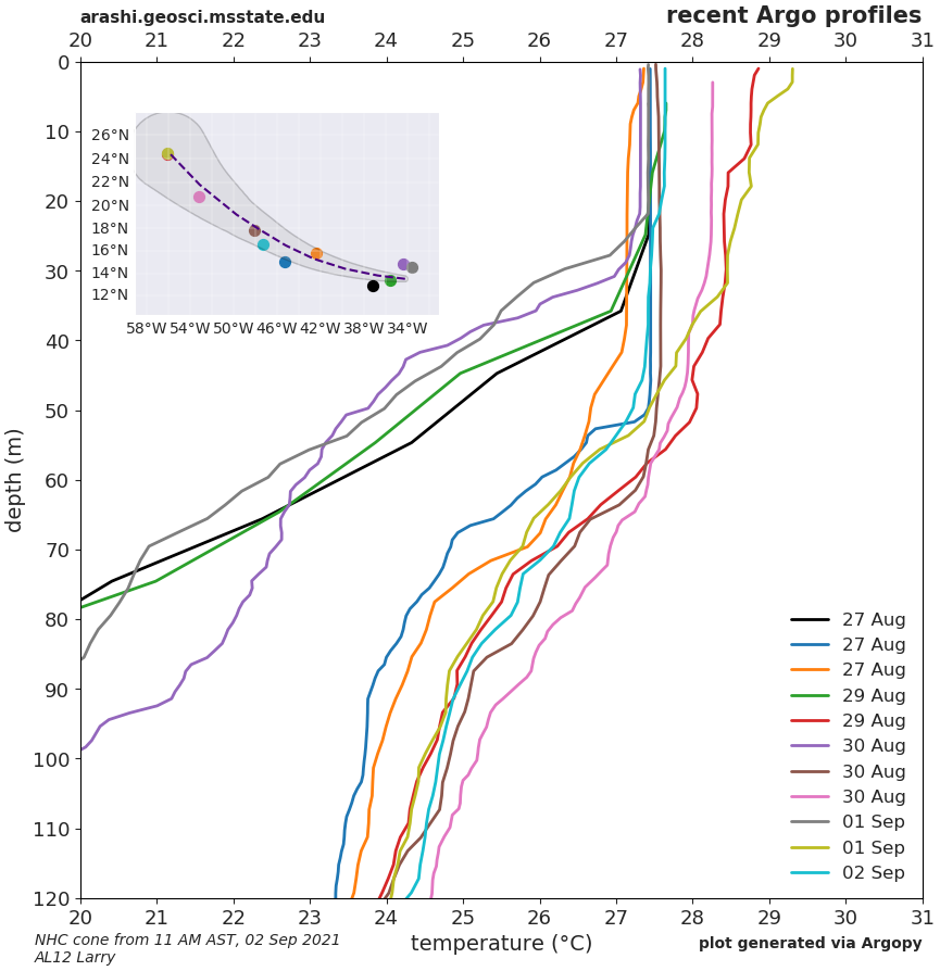
- advisory 008 temperature (11am AST 2 September 2021)
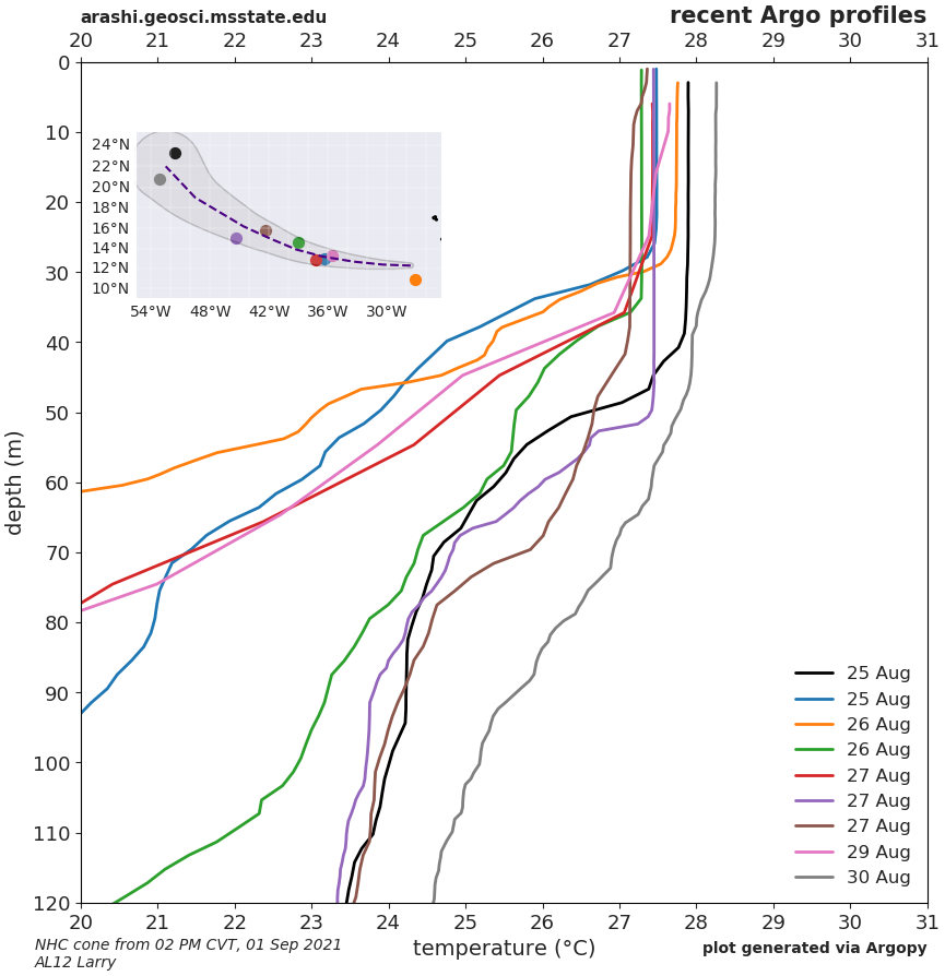
- advisory 004 temperature (2pm CVT 1 September 2021)
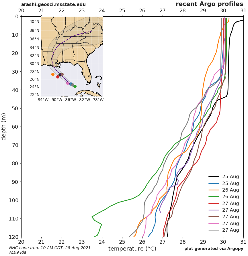
- advisory 009 temperature (10am CDT 28 August 2021)
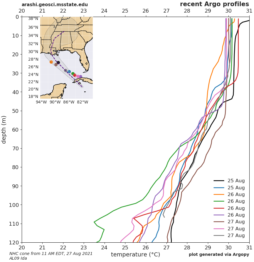
- advisory 005 temperature (11am EDT 27 August 2021)
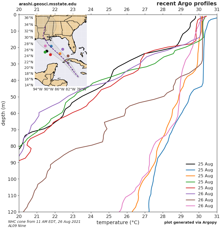
- advisory 001 temperature (11am EDT 26 August 2021)
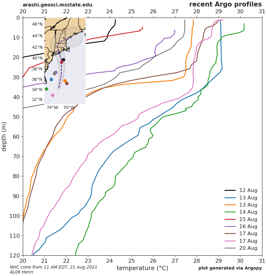
- advisory 023 temperature (11am EDT 21 August 2021)
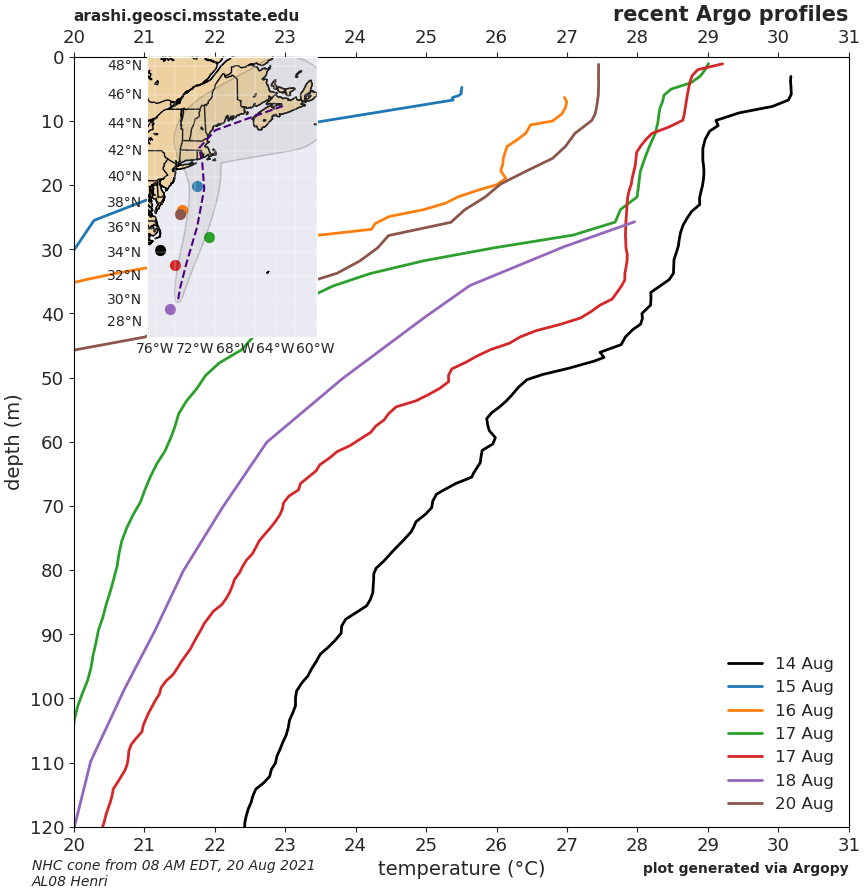
- advisory 018A temperature (8am EDT 20 August 2021)
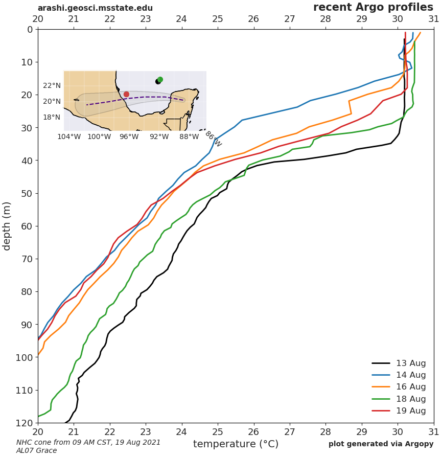
- advisory 028A temperature (7am CDT 20 August 2021)
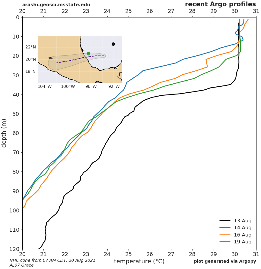
- advisory 025 temperature (10am CDT 19 August 2021)
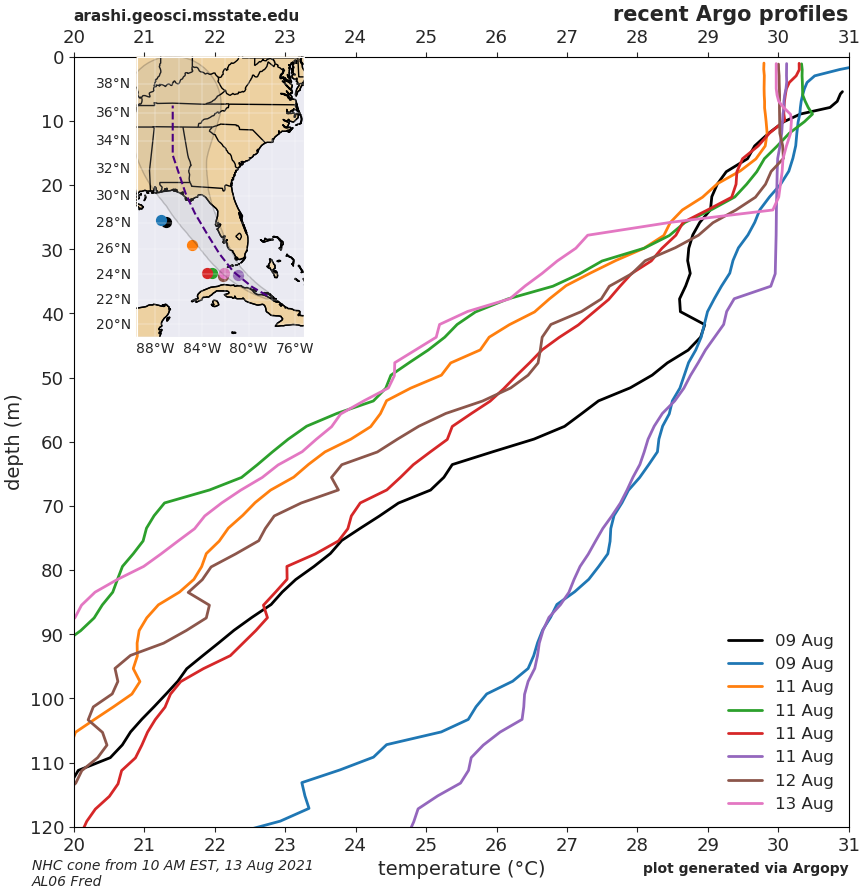
- advisory 016 temperature (10am EDT 13 August 2021)
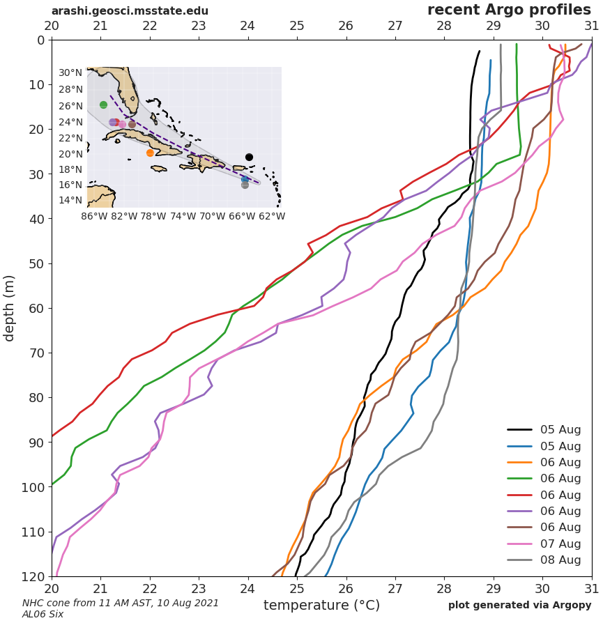
- advisory 004 temperature (11am AST 10 August 2021)
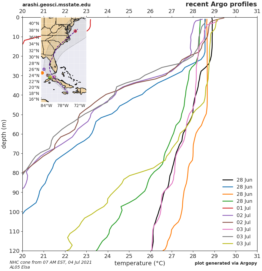
- advisory 016A temperature (8am EDT 4 July 2021)
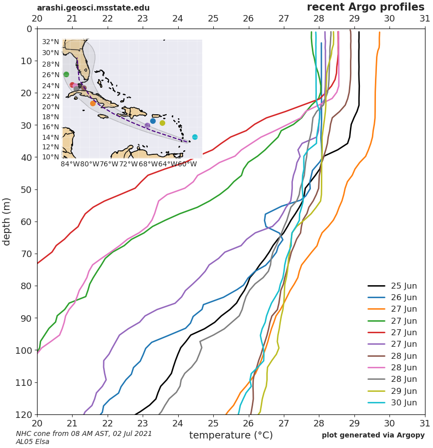
- advisory 012A temperature (8am AST 3 July 2021)
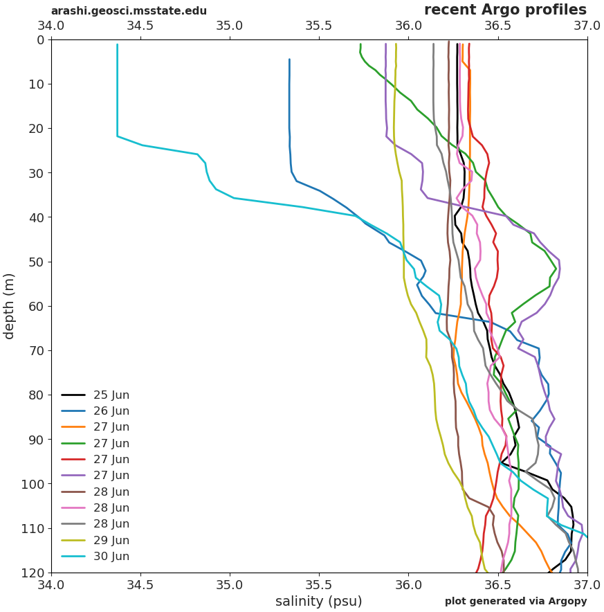
- advisory 008 temperature and salinity (8am AST 2 July 2021)
tropical Atlantic
Gulf of Mexico
Caribbean Sea
(page last updated 03 Nov 2021)